

San Felipe de Austin Plat Tour
Virtual Grounds collaborated with the Texas Historical Commission to create and develop virtual map tours of the San Felipe de Austin State Historic Site. The prototype project offered digital alternatives for the visualization and interpretation of the vanished 1823 settlement through multiple web-based and mobile technologies. San Felipe de Austin was the unofficial capital of American Texas, and it was completely burned down in 1836.
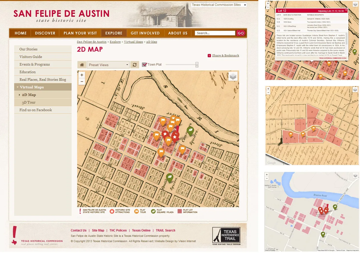
The web interface displayed a 3D virtual tour and a 2D map tour of the settlement superimposed on the historic plat, featuring customized information boxes for selected Points of Interest (POIs).
Services: 2D and 3D web-based map tour development, historic plat digitization and georeferencing, mobile app development, and interactive Points of Interest (POI) content authoring.
Exploring the Historic Plat
The tours were based on the historic town plat drawn by the settlement's founder, Stephen F. Austin, enriched with information on notable occupants of the lots and lands of the vanished colony.
Visualizing the Settlement in 3D
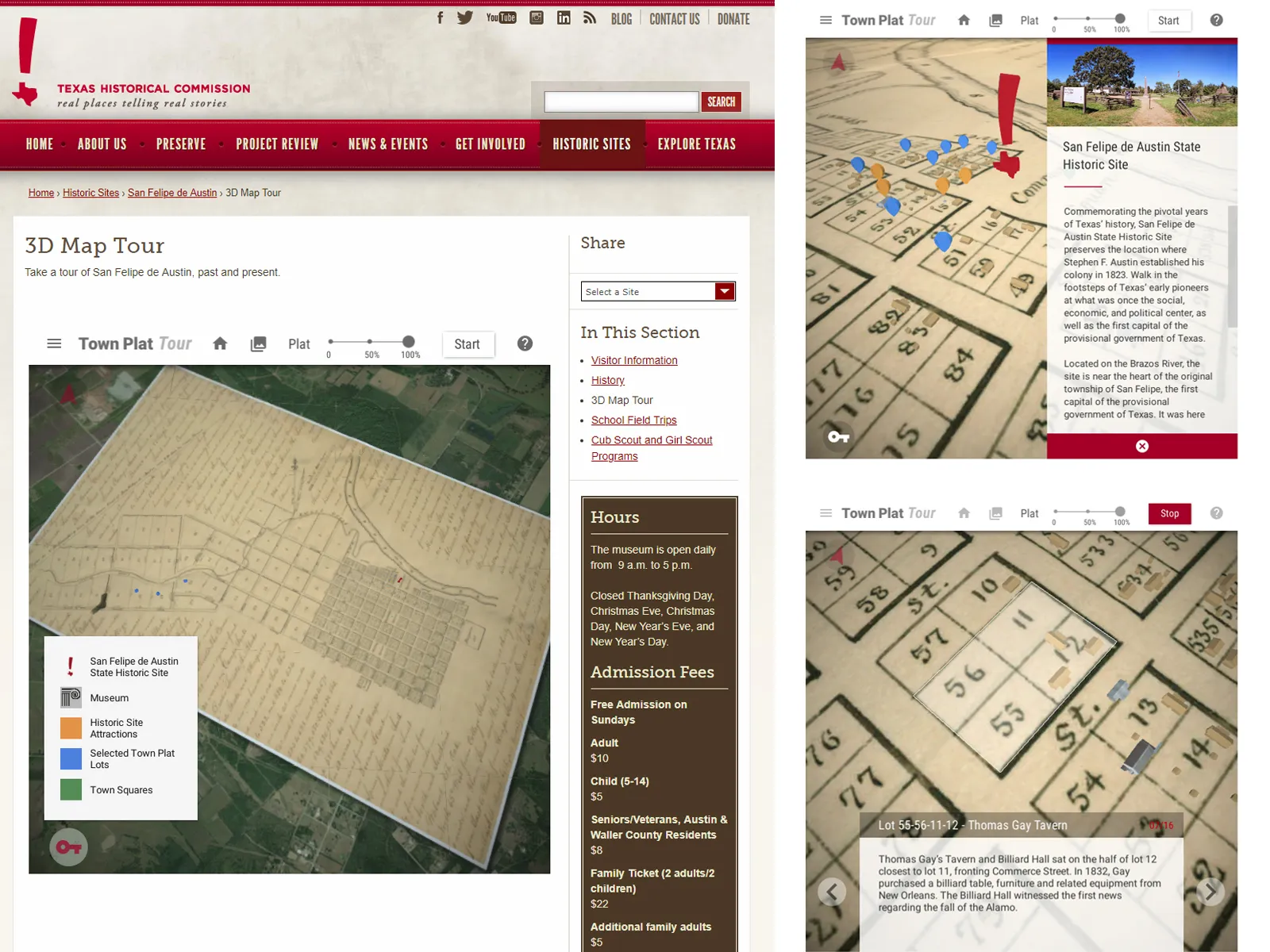
The 3D virtual tour positioned schematic representations of buildings overlaid on top of the original town plat, providing a visualization of the possible occupation of the site. A preset tour guided visitors through featured lots.
For Online and On-site Visitors
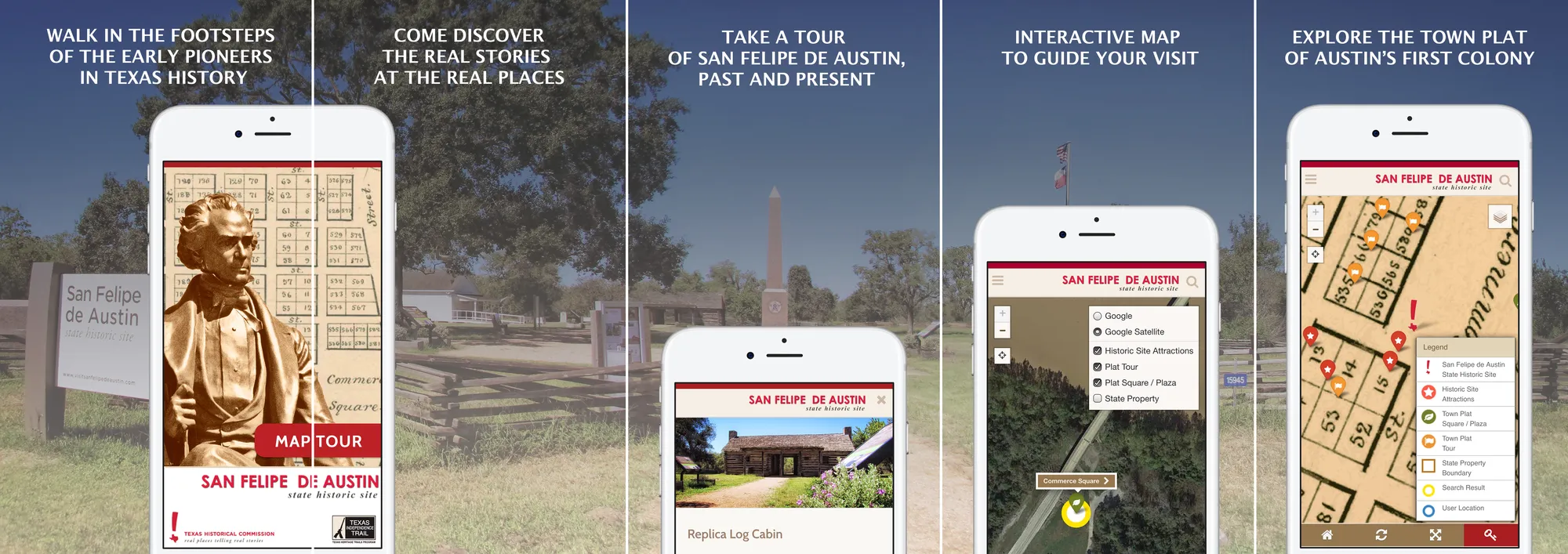
The tour of San Felipe was also featured on a mobile app, initially launched as a mobile website. The app replicated the points of interest also present in the desktop map tour.
Multi-Platform Interpretation Tools
The story of San Felipe de Austin unfolds across platforms and across time. A curated set of multi-platform interpretation tools centered on digital maps for desktop and mobile, brought the vanished settlement history to life for visitors on-site and online. The desktop experience offered both a flat plat map tour and a schematic 3D visualization of the colonial layout, while the mobile apps extended the tour to iOS and Android in a format built for walking the actual grounds.
Helping Interpret the History of San Felipe de Austin
The map tours helped connect historical events and real places, exploring the original town plat as a spatial reference of the 1820s occupation. The plat became a direct link between the documentary record and the ground where the colony stood.
The 2D and 3D tours were hosted on the Texas Historical Commission website dedicated to San Felipe's history, serving online visitors and those planning a trip to the State Historic Site.
Desktop Virtual Tour
The tour gave online visitors direct control over their exploration: adjusting the opacity of the historic plat overlay, opening information panels for individual lots, and navigating freely or following a guided sequence through featured sites. The experience was built to run entirely in the browser.
